

North Surveying & Mapping
Land Surveying
Contact Us
We will get back to you as soon as possible.
Please try again later.
-
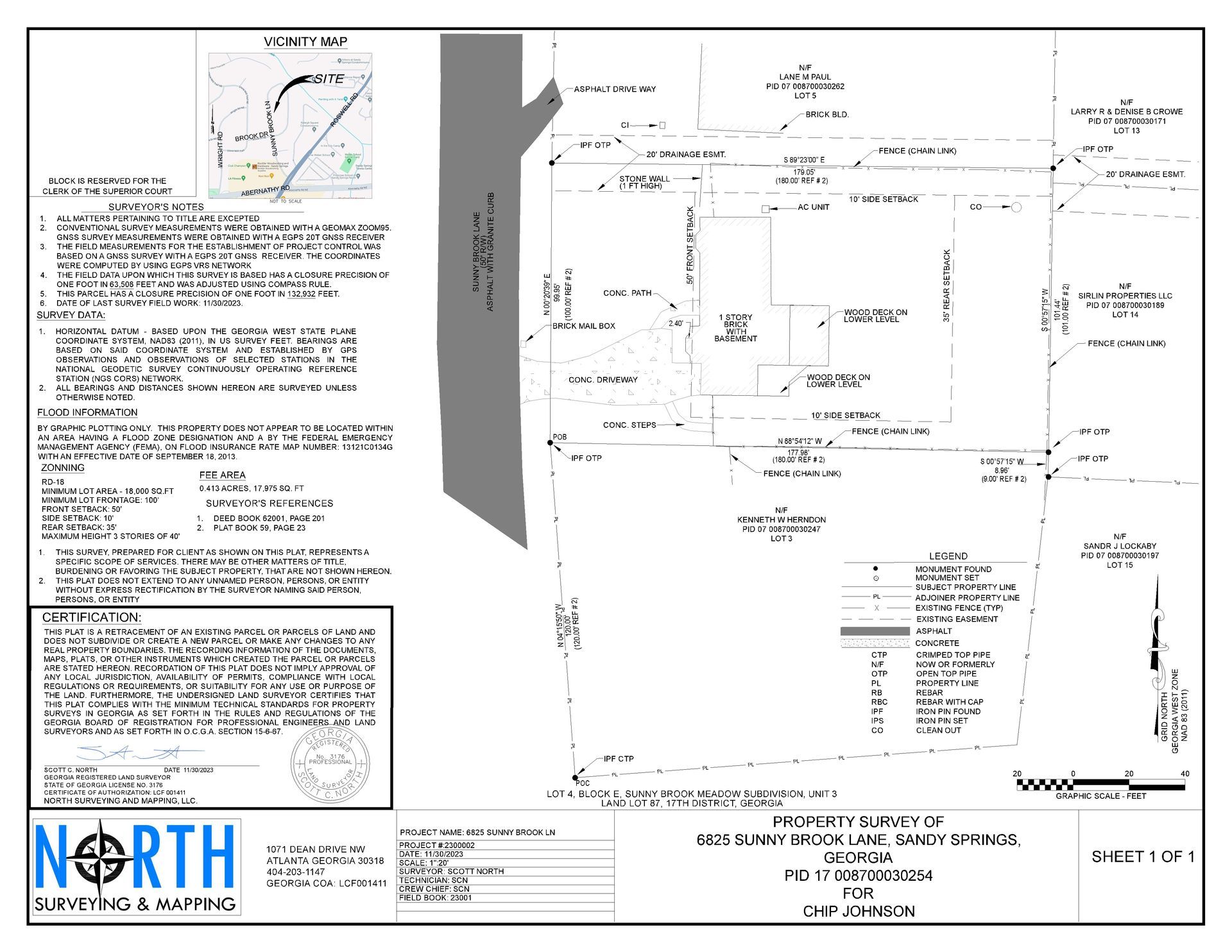
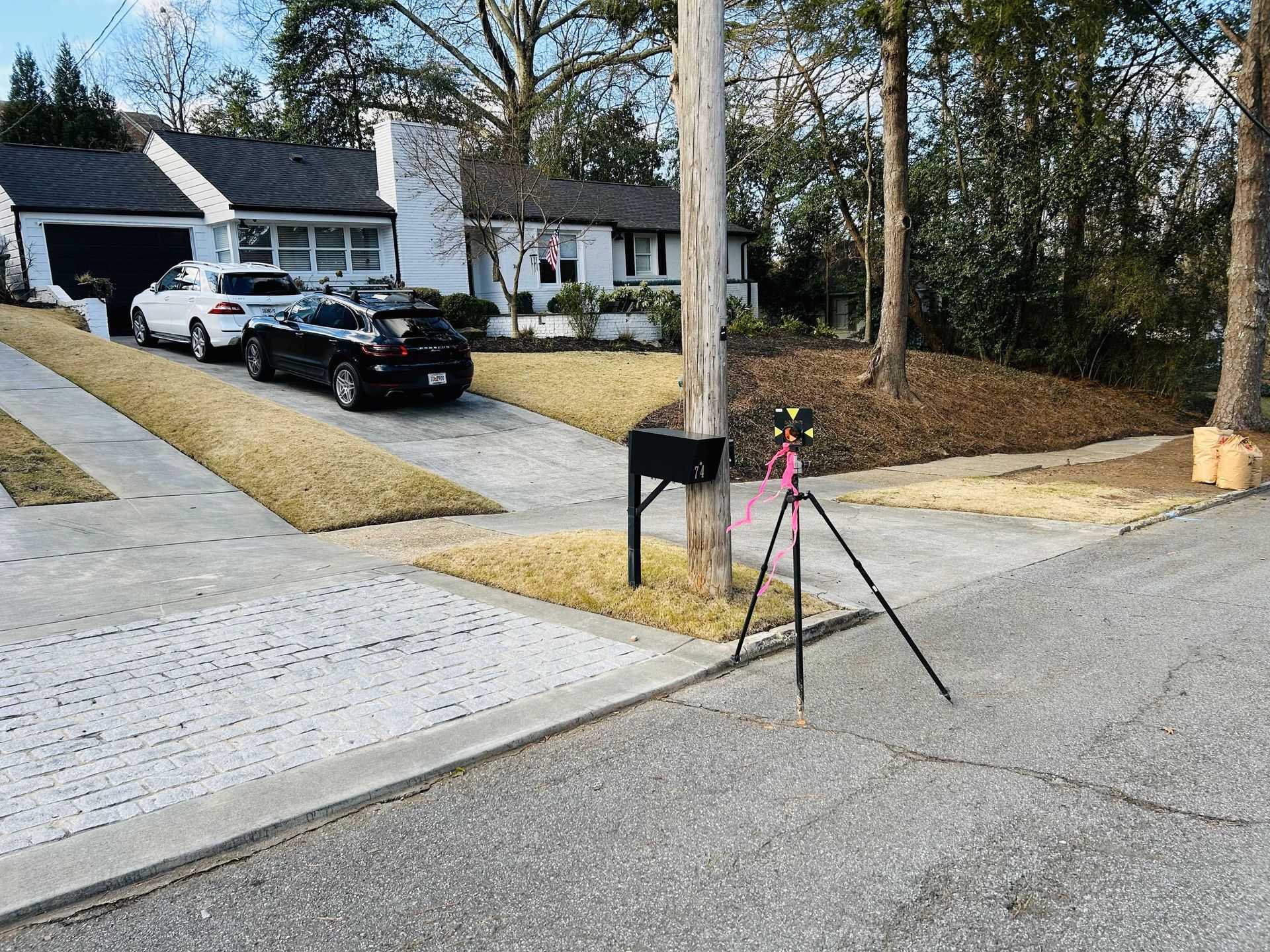
Lot Corner & Property Line Staking
Lot corner and property line staking services are used to mark the precise location of the corners of a lot. This is important for a variety of reasons, such as:
- To ensure that property owners are building within their property boundaries.
- To prevent property disputes with neighbors.
- To comply with local building codes.
- To accurately survey the lot for planning purposes.
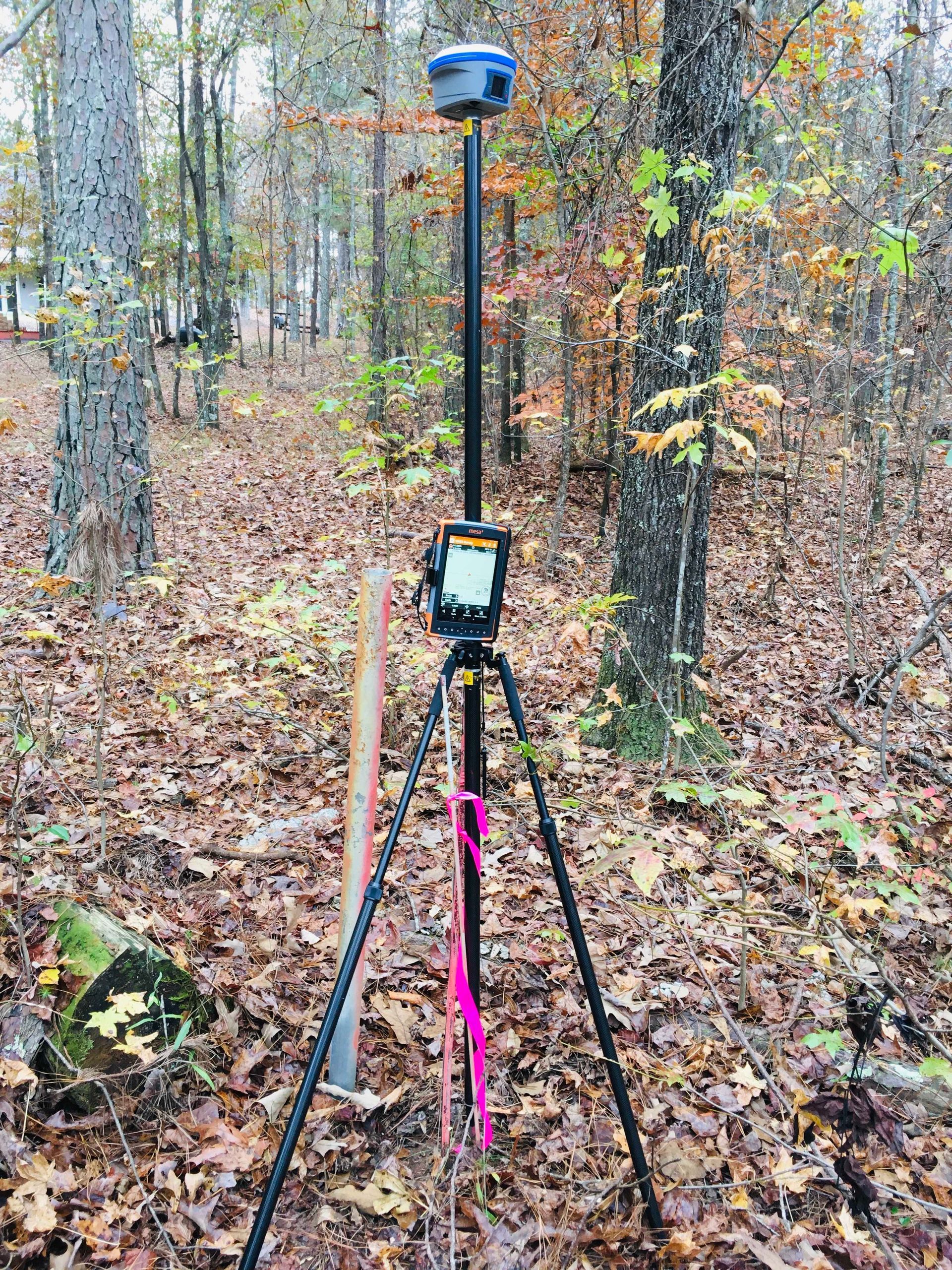
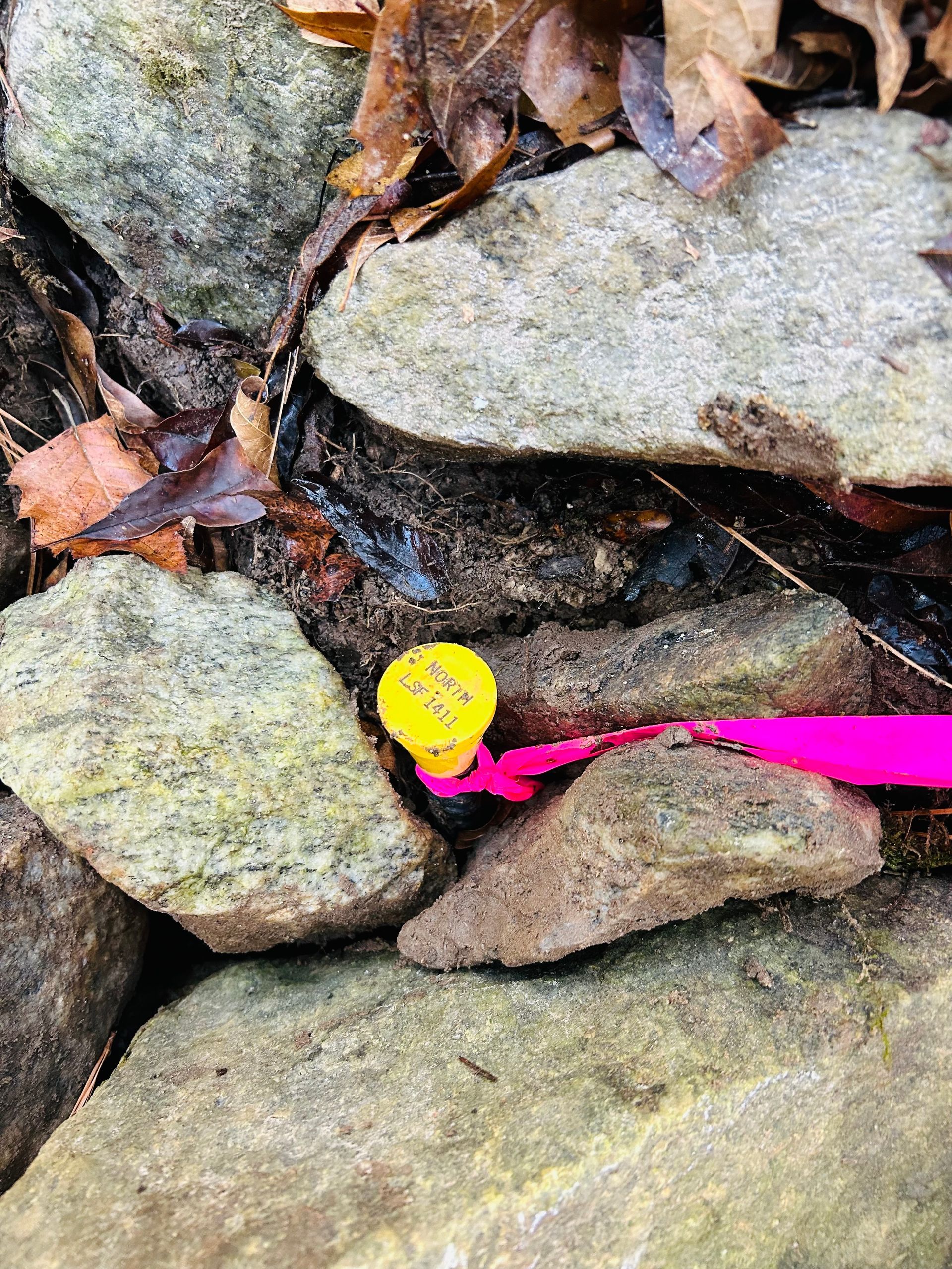
Lot corner staking services are typically conducted by licensed land surveyors using a variety of tools and techniques, including GPS, total stations, and public records. The surveyor will locate the property corners as identified in the property deed and mark them with stakes or other visible markers.
If you are planning to build on a lot, it is important to have the lot corners staked by a qualified land surveyor. This will ensure that your construction project is compliant with local building codes and that you are building within your property boundaries.
Here are some of the benefits of having lot corner staking services completed:
- Avoid property disputes: By having the lot corners staked, you can be sure that you are building within your property boundaries and avoid potential property disputes with your neighbors.
- Comply with local building codes: Most local building codes require that the lot corners be staked before construction begins.
- Accurate survey: Lot corner staking provides an accurate survey of the lot, which can be helpful for planning purposes. If you are considering having lot corner staking services completed, be sure to hire a qualified land surveyor.
A qualified land surveyor will have the experience and expertise to ensure that your lot corners are staked accurately and professionally.
-
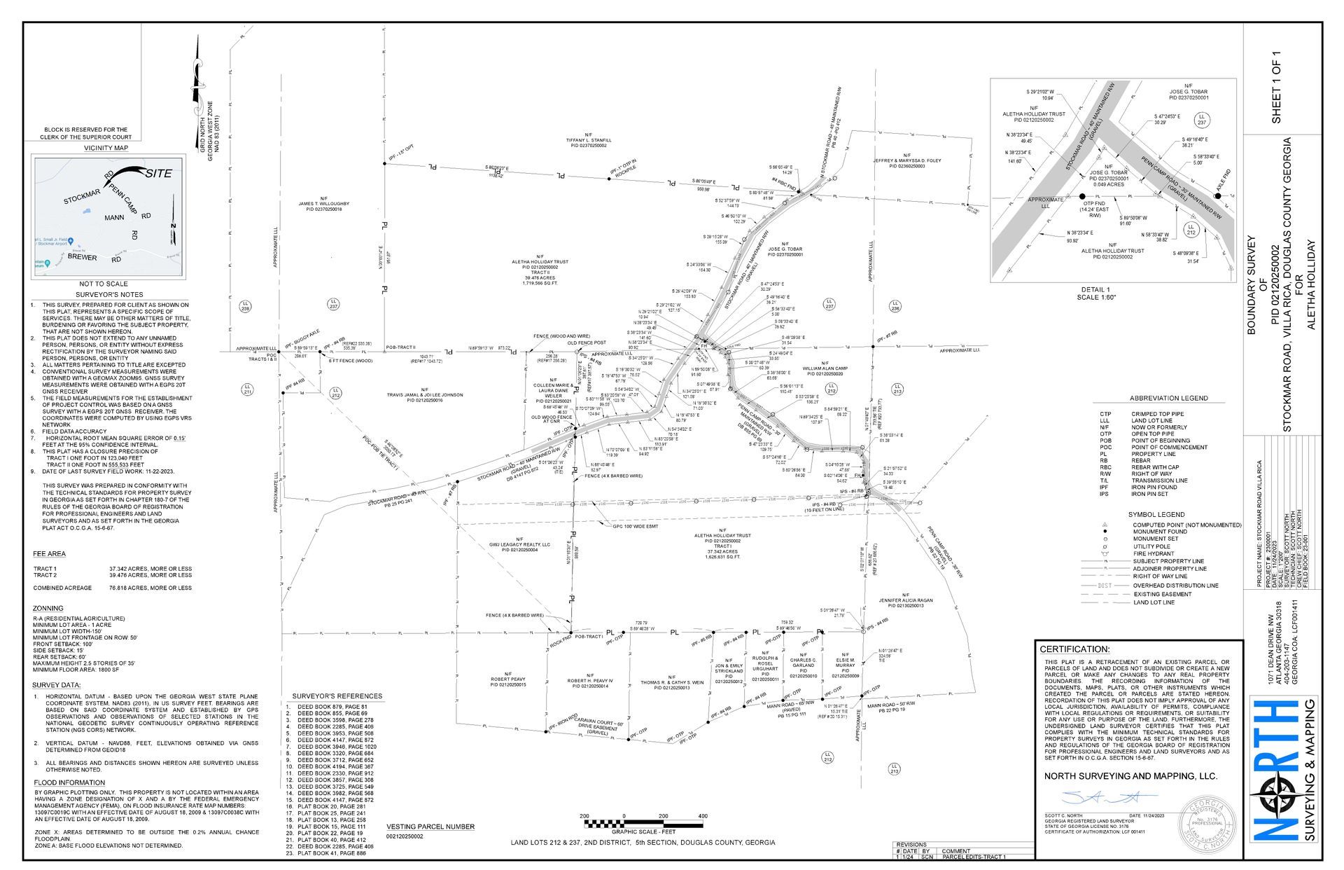
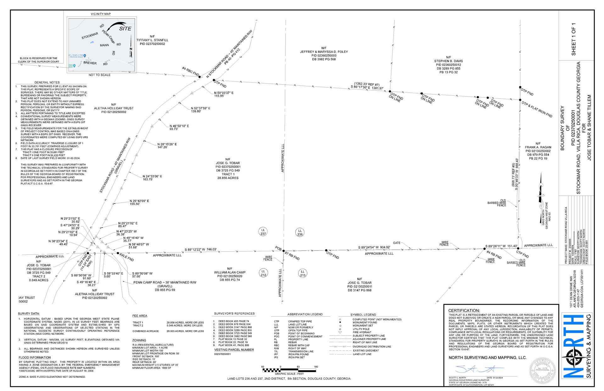
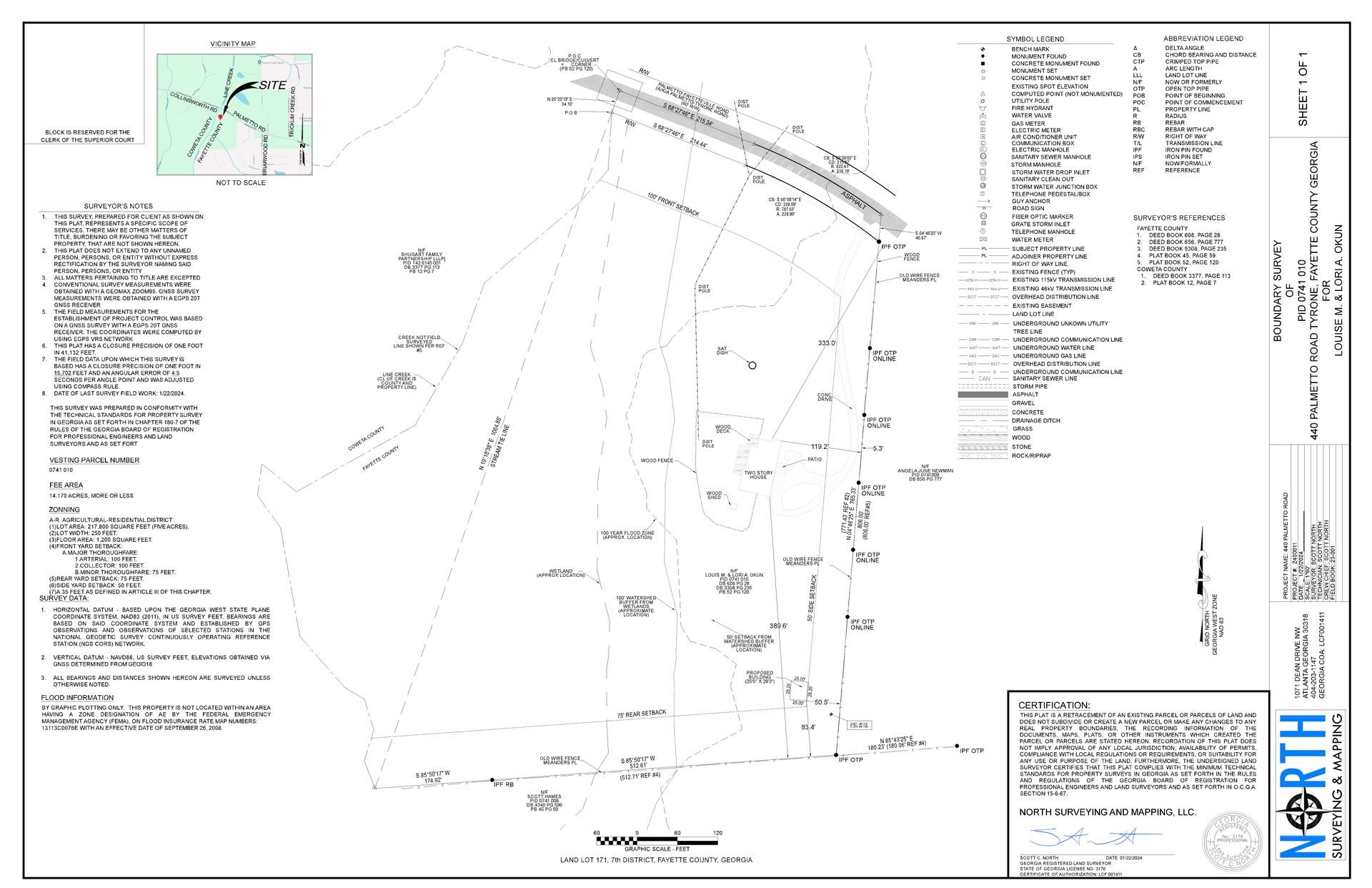
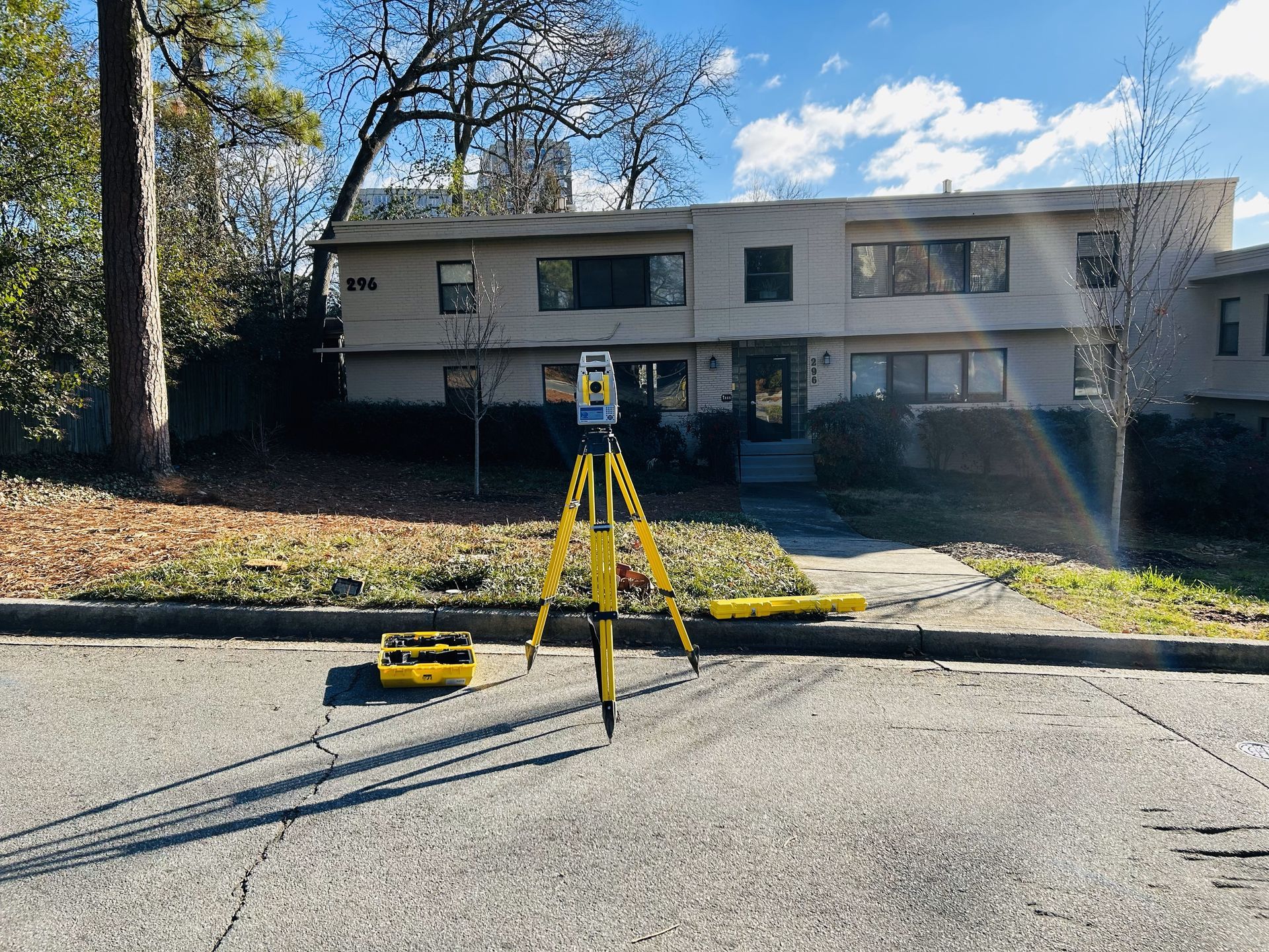
Boundary Surveys
Boundary survey services are used to determine the precise location of the property boundaries of a piece of land. This information is essential for a variety of purposes, such as buying or selling a property, building a fence or other structure, and resolving property disputes.
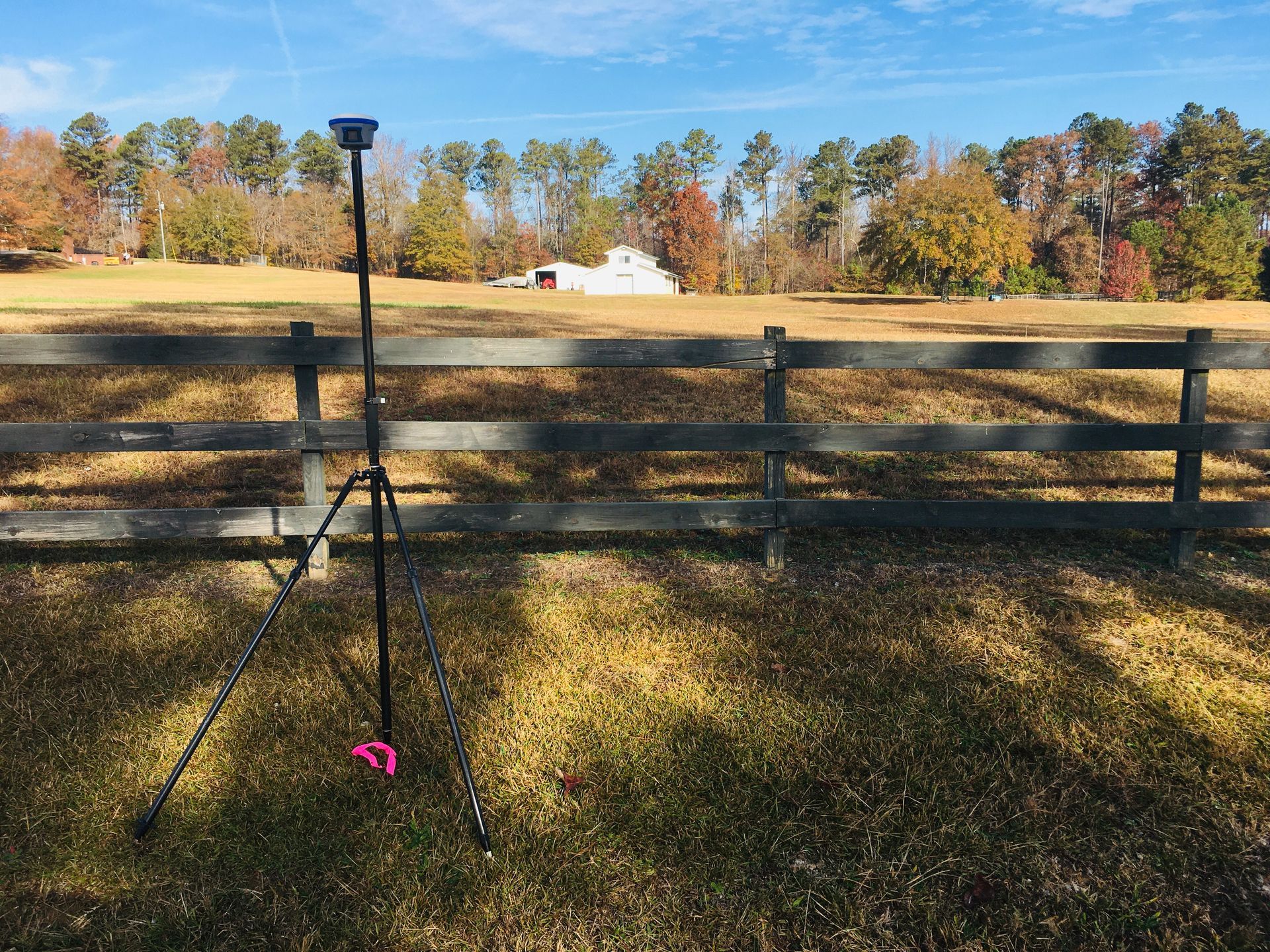
Boundary surveys are typically conducted by licensed land surveyors using a variety of tools and techniques, including GPS, total stations, and public records. The surveyor will locate the property corners and boundary lines as identified in the property deed. The surveyor will also research the property's title history to identify any potential easements or encroachments.
Once the survey is complete, the surveyor will prepare a boundary survey plat. This plat is a legal document that shows the property boundaries and any easements or encroachments.
Boundary survey plats are often required by lenders and title companies when buying or selling a property. Boundary survey services can be a valuable investment for any property owner. By having a boundary survey completed, you can be sure that you know the exact location of your property boundaries and avoid potential property disputes in the future.
Here are some of the benefits of having a boundary survey completed:
- Avoid property disputes: A boundary survey can help to prevent property disputes with your neighbors by clearly delineating your property boundaries.
- Protect your investment: A boundary survey can help to protect your investment in your property by ensuring that you are not encroaching on your neighbors' land or that your neighbors are not encroaching on your land. Identify easements and encroachments: A boundary survey can identify any easements or encroachments on your property. This information can be important when buying or selling a property or when planning construction projects.
- Meet lender and title company requirements: Lenders and title companies often require a boundary survey plat when buying or selling a property.
If you are considering having a boundary survey completed, be sure to hire a qualified land surveyor. A qualified land surveyor will have the experience and expertise to ensure that your survey is conducted accurately and professionally.
-
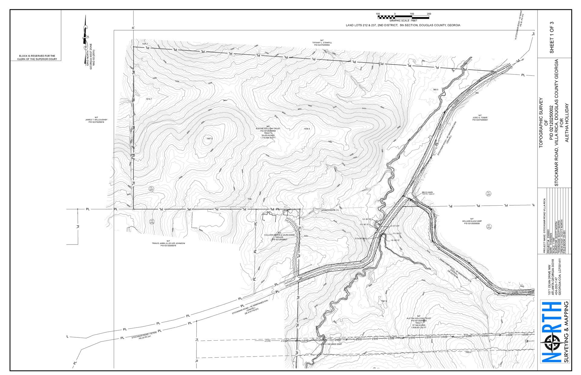
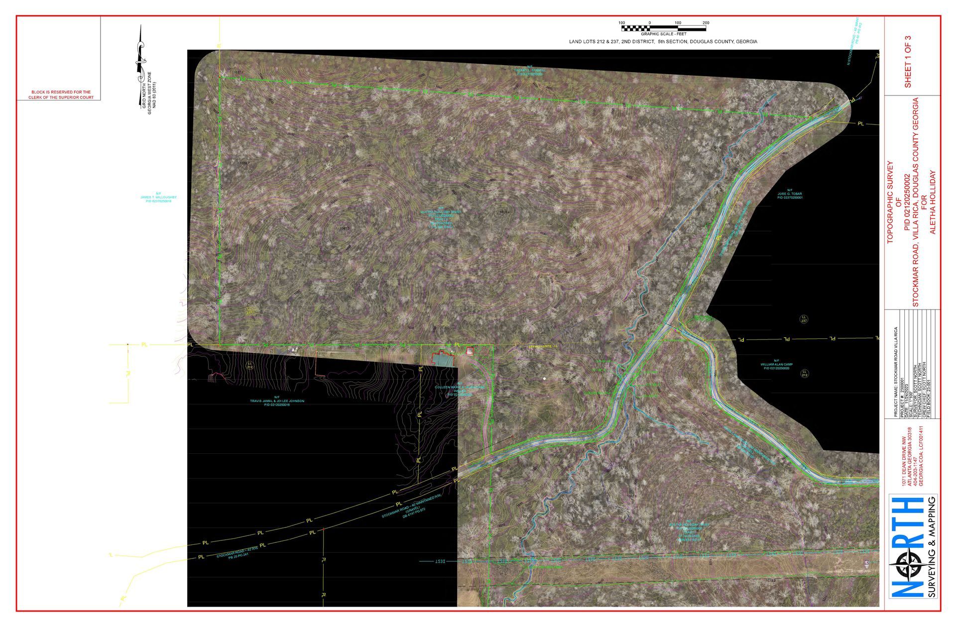
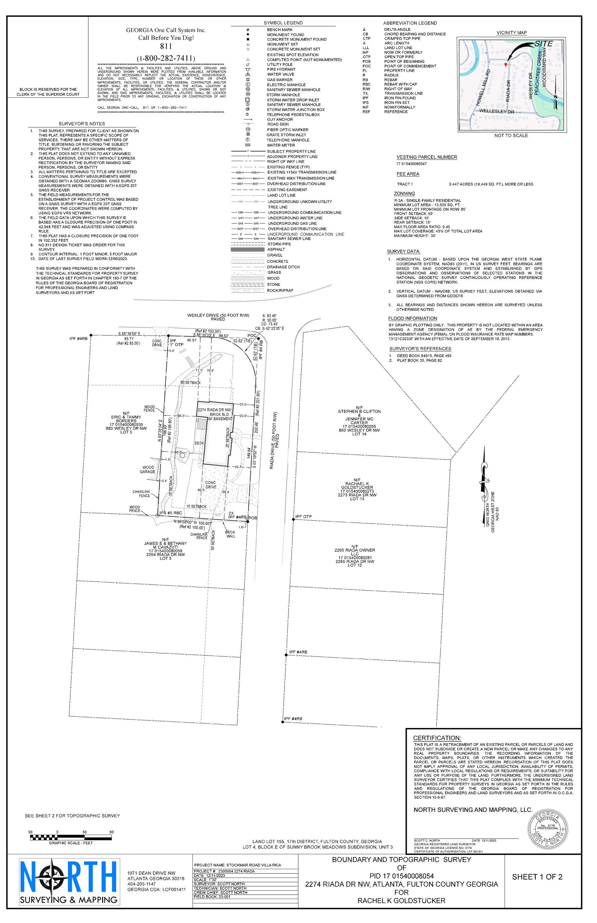
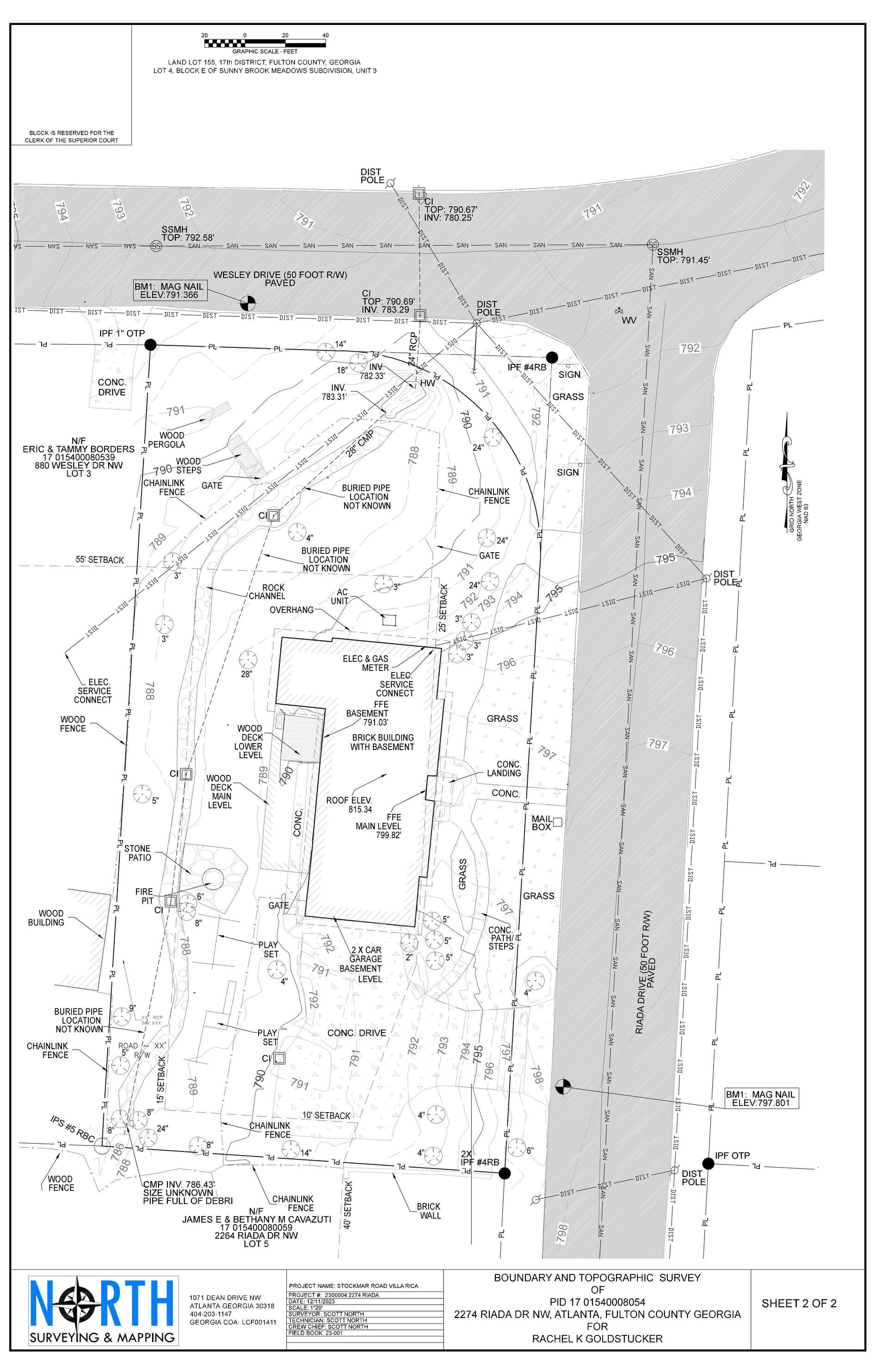
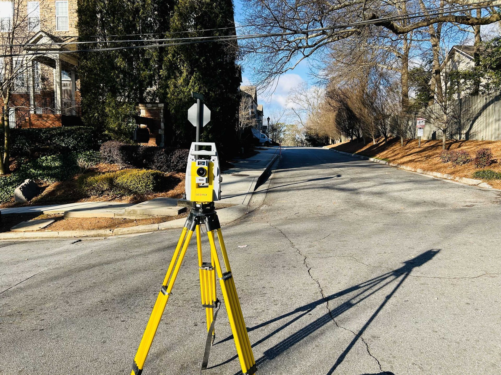
Topographic Surveys
Topographic survey services are used to create a detailed map of the surface features and elevation changes of a piece of land. This information can be used for a variety of purposes, such as planning construction projects, designing drainage systems, and assessing flood risk.
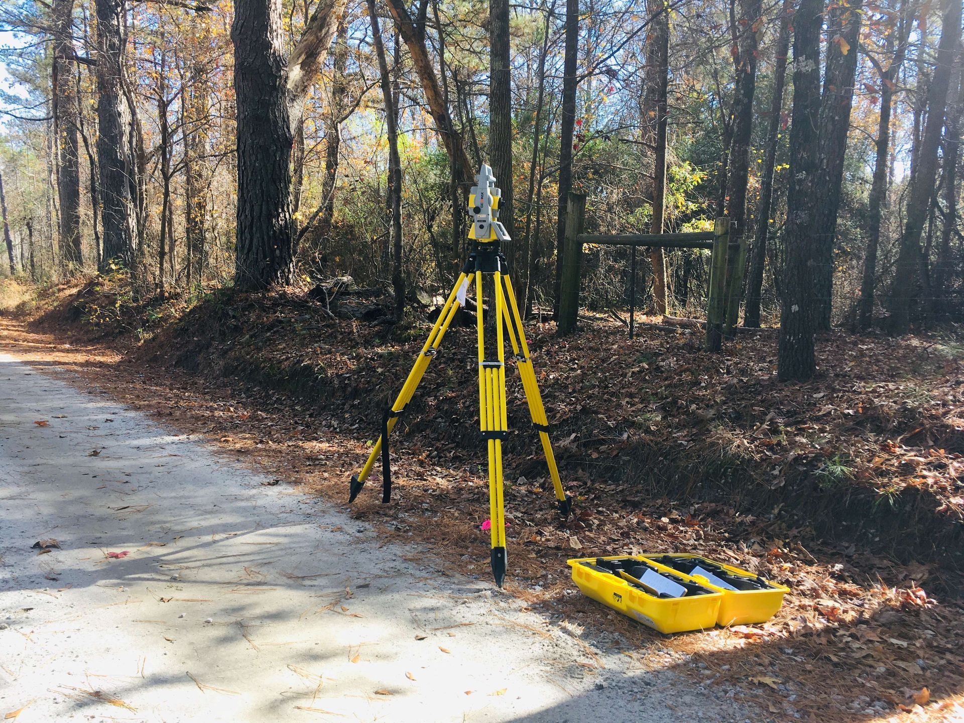
Topographic surveys are typically conducted by licensed land surveyors using a variety of tools and techniques, including GPS, total stations, and laser scanners. The surveyor will collect data on the location, elevation, and type of all features on the property, such as buildings, roads, trees, and water bodies.
Once the data has been collected, the surveyor will create a topographic map. This map will show the contours of the land, as well as the location and elevation of all features. Topographic maps can be used to visualize the land surface and identify potential problems, such as steep slopes or areas prone to flooding.
Topographic survey services are essential for a variety of projects, including:
Residential and commercial construction:
- Topographic surveys are used to plan the layout of new buildings and other structures, as well as to ensure that they are built in a safe and stable location.
- Infrastructure projects: Topographic surveys are used to design roads, bridges, and other infrastructure projects.
- Environmental assessments: Topographic surveys are used to assess the environmental impact of proposed projects, such as mines or landfills.
- Land-use planning: Topographic surveys can be used to develop land-use plans that protect natural resources and minimize the risk of flooding and other hazards.
If you are planning a project that requires a topographic survey, be sure to hire a qualified land surveyor to ensure that the survey is conducted accurately and professionally.
-
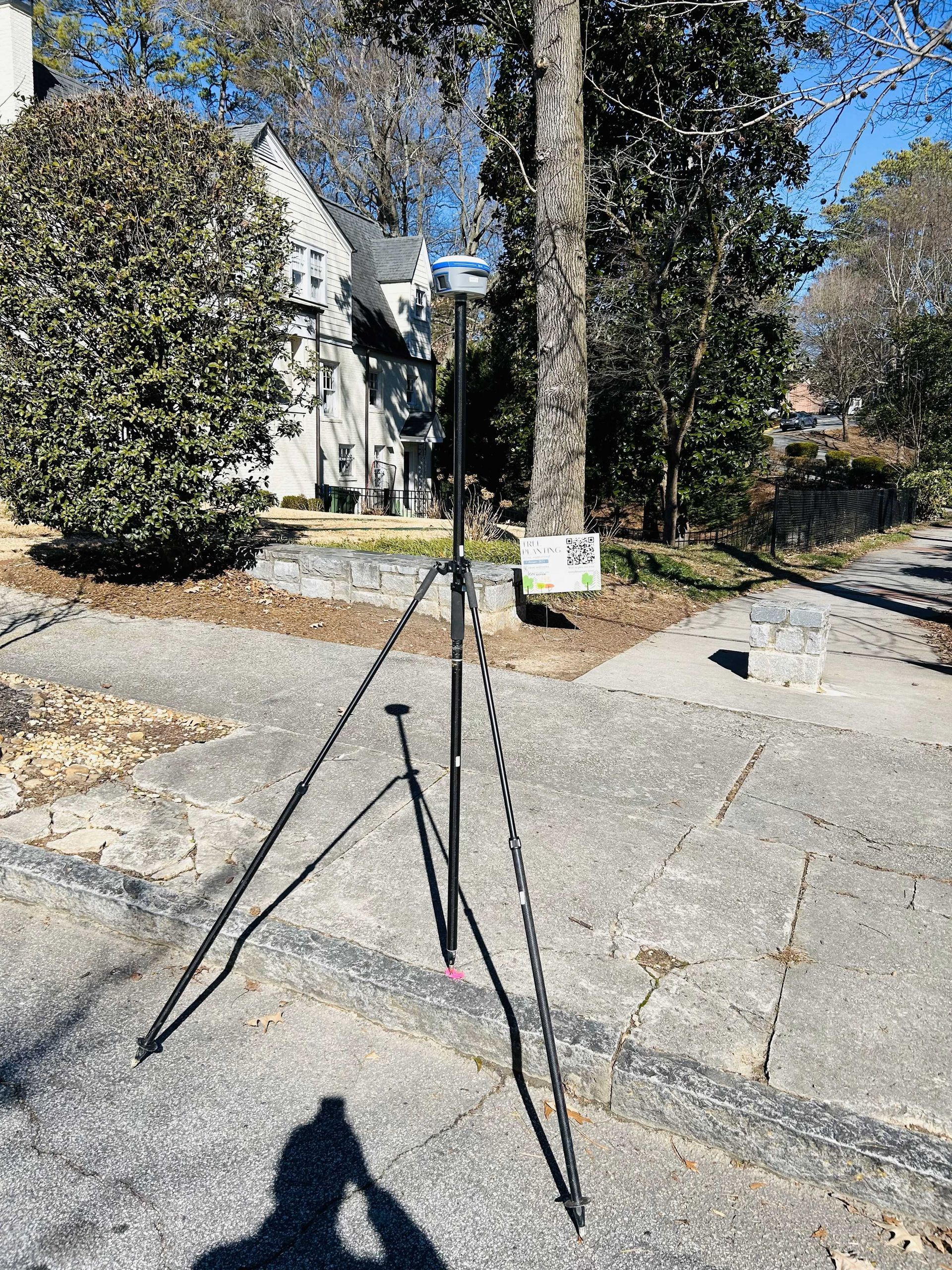
ALTA/NSPS Land Title Surveys
ALTA/NSPS survey services are a type of land survey that meets the standards set by the American Land Title Association (ALTA) and the National Society of Professional Surveyors (NSPS). ALTA/NSPS surveys are typically required by commercial lenders when financing a property purchase.
ALTA/NSPS surveys are more comprehensive than standard land surveys. They include additional information, such as:
- A detailed description of the property boundaries, including all easements and encroachments
- The location and elevation of all improvements on the property, such as buildings, roads, and utilities
- A certification from the surveyor that the survey meets all ALTA/NSPS standards
ALTA/NSPS surveys can be more expensive than standard land surveys, but they can save money in the long run by helping to prevent title disputes and other problems.
Here are some of the benefits of having an ALTA/NSPS survey completed:
- Reduce the risk of title disputes: An ALTA/NSPS survey can help to identify and resolve any potential title issues before a property purchase is finalized. This can reduce the risk of costly title disputes in the future.
- Protect your investment: An ALTA/NSPS survey can help to protect your investment in a property by ensuring that you have a clear and accurate understanding of the property boundaries and any easements or encroachments.
- Meet lender requirements: Most commercial lenders require an ALTA/NSPS survey when financing a property purchase.
- Get accurate information for planning purposes: An ALTA/NSPS survey provides comprehensive information about the property, which can be helpful for planning purposes, such as construction projects or land development.
- If you are considering purchasing a commercial property, it is important to have an ALTA/NSPS survey completed. An ALTA/NSPS survey can help to protect your investment and reduce the risk of problems in the future.
Here are some examples of when an ALTA/NSPS survey is required:
- When purchasing a commercial property
- When refinancing a commercial property
- When developing a commercial property
- When resolving a property dispute
- When making a boundary adjustment
- When subdividing a property
If you are unsure whether or not you need an ALTA/NSPS survey, it is best to consult with a qualified land surveyor.
-
Construction Support Services
Construction survey services are used to support the planning, design, and construction of projects, such as roads, bridges, buildings, and utilities. Construction surveyors collect data on the location, elevation, and other characteristics of the project site and surrounding area. This data is used to create maps and drawings that guide construction workers and ensure that the project is built to specifications.
Construction survey services are typically provided by licensed land surveyors. Land surveyors have the training and experience to use a variety of tools and techniques to collect accurate and reliable data.
Construction survey services may include:
- Site surveys: Site surveys are conducted to gather information about the existing conditions of the project site. This information includes the location of property boundaries, easements, and utilities. Site surveys are also used to determine the topography of the site and to identify any potential hazards.
- Staking: Staking is used to mark the location of important points on the project site, such as building corners, road alignments, and utility lines. Staking helps to ensure that the project is built to specifications and that it does not encroach on neighboring properties.
- Grade control: Grade control is used to ensure that the project is built to the correct elevation. Grade controllers use a variety of tools and techniques to monitor the elevation of the project site and to ensure that it is within the specified tolerances.
- As-built surveys: As-built surveys are conducted after the project is completed to verify that it was built to specifications. As-built surveys are also used to document the final condition of the project site.
Construction survey services are essential for the success of any construction project. By having construction survey services completed by a qualified land surveyor, project owners can ensure that their project is built to specifications, on time, and within budget.
Here are some of the benefits of having construction survey services completed:
- Improved accuracy and efficiency: Construction surveys help to improve the accuracy and efficiency of construction projects. By having accurate and up-to-date information about the project site, construction workers can avoid costly mistakes and delays.
- Reduced risk: Construction surveys help to reduce the risk of construction accidents and injuries. By identifying potential hazards on the project site, construction workers can take steps to avoid them.
- Compliance with regulations: Construction surveys can help to ensure compliance with local and federal regulations. For example, many municipalities require construction surveys to be completed before a building permit can be issued.
- Peace of mind: Knowing that your construction project is being built to specifications and in compliance with all applicable regulations can give you peace of mind.
If you are planning a construction project, be sure to hire a qualified land surveyor to provide construction survey services. A qualified land surveyor will have the experience and expertise to ensure that your project is a success.
-
Asbuilt Surveys
As-built survey services are used to create a record of the existing conditions of a property or structure after construction or renovation has been completed. As-built surveys are typically required by lenders, insurance companies, and government agencies. They can also be used by property owners and managers to track changes to their property over time.
As-built surveys are typically conducted by licensed land surveyors using a variety of tools and techniques, including GPS, total stations, and laser scanners. The surveyor will collect data on the location, elevation, and type of all features on the property or structure, such as buildings, roads, utilities, and landscaping. The surveyor will also identify any easements or encroachments on the property.
Once the data has been collected, the surveyor will create an as-built survey map. This map will show the existing conditions of the property or structure, including the location, elevation, and type of all features. As-built survey maps can be used for a variety of purposes, such as:
- Identifying and resolving construction errors
- Planning future construction or renovation projects
- Assessing the value of a property
- Complying with local and federal regulations
As-built survey services can be a valuable investment for any property owner. By having an as-built survey completed, property owners can ensure that they have an accurate record of the existing conditions of their property and that they are in compliance with all applicable regulations.
Here are some of the benefits of having as-built survey services completed:
- Accurate record of existing conditions: An as-built survey provides an accurate record of the existing conditions of a property or structure. This information can be used to identify and resolve construction errors, plan future construction or renovation projects, and assess the value of a property.
- Compliance with regulations: As-built surveys can help to ensure compliance with local and federal regulations. For example, many municipalities require as-built surveys to be submitted before a building permit can be issued.
- Peace of mind: Knowing that you have an accurate record of the existing conditions of your property can give you peace of mind. This is especially important if you are planning to sell your property or if you are concerned about potential construction errors.
If you are considering having as-built survey services completed, be sure to hire a qualified land surveyor. A qualified land surveyor will have the experience and expertise to ensure that your as-built survey is conducted accurately and professionally.
-
Alcoholic Beverage License Surveys
Alcoholic beverage license survey services are used to collect data about the location and characteristics of businesses that sell alcoholic beverages. This data is used by state and local governments to determine whether to issue an alcoholic beverage license to a particular business.
Alcoholic beverage license surveys are typically conducted by licensed land surveyors. Land surveyors have the training and experience to use a variety of tools and techniques to collect accurate and reliable data.
Alcoholic beverage license surveys may include:
- Site surveys: Site surveys are conducted to gather information about the existing conditions of the property where the business will be located. This information includes the location of property boundaries, easements, and utilities. Site surveys are also used to determine the topography of the property and to identify any potential hazards.
- Distance measurements: Alcoholic beverage license surveys must measure the distance between the proposed business and certain locations, such as schools, churches, and residential areas. These distance measurements are used to ensure that the business complies with all applicable zoning and licensing regulations.
- Map preparation: Alcoholic beverage license surveys typically include a map that shows the location of the proposed business and the surrounding area. This map is used by government officials to review the application and to make a decision about whether to issue a license.
Alcoholic beverage license surveys are an important part of the licensing process. By having an alcoholic beverage license survey completed by a qualified land surveyor, business owners can ensure that their application is complete and accurate. This will increase their chances of having their license approved.
Here are some of the benefits of having alcoholic beverage license survey services completed:
- Increased chances of approval: Alcoholic beverage license surveys can help to increase your chances of having your license approved by the government. By having a complete and accurate survey, you can demonstrate to government officials that your business complies with all applicable regulations.
- Peace of mind: Knowing that your alcoholic beverage license survey was completed by a qualified land surveyor can give you peace of mind. You can be confident that the survey is accurate and that it meets all of the requirements of the licensing process.
- Avoid costly delays: By having an alcoholic beverage license survey completed early in the licensing process, you can avoid costly delays. If the survey identifies any potential problems, you can address them before you submit your application. This can save you time and money in the long run.
If you are planning to apply for an alcoholic beverage license, be sure to hire a qualified land surveyor to complete an alcoholic beverage license survey. A qualified land surveyor will have the experience and expertise to ensure that your survey is accurate and meets all of the requirements of the licensing process.
-
Subdivision Surveys
Subdivision survey services are used to divide a large parcel of land into smaller parcels, or lots. Subdivision surveys are required by most local governments before a new subdivision can be developed.
Subdivision surveys are typically conducted by licensed land surveyors. Land surveyors have the training and experience to use a variety of tools and techniques to collect accurate and reliable data.
Subdivision surveys may include:
- Site surveys: Site surveys are conducted to gather information about the existing conditions of the property to be subdivided. This information includes the location of property boundaries, easements, and utilities. Site surveys are also used to determine the topography of the property and to identify any potential hazards.
- Lot layout: Subdivision surveys typically include a layout of the proposed lots, showing their size, shape, and location. The lot layout must comply with all applicable zoning and land-use regulations.
- Map preparation: Subdivision surveys typically include a map that shows the proposed subdivision and the surrounding area. This map is used by government officials to review the application and to make a decision about whether to approve the subdivision.
Subdivision survey services are an important part of the land development process. By having a subdivision survey completed by a qualified land surveyor, developers can ensure that their subdivision complies with all applicable regulations and that it is built to the satisfaction of the local government.
Here are some of the benefits of having subdivision survey services completed:
- Compliance with regulations: Subdivision surveys help to ensure compliance with all applicable zoning and land-use regulations. This can avoid costly delays and problems in the future.
- Peace of mind: Knowing that your subdivision survey was completed by a qualified land surveyor can give you peace of mind. You can be confident that the survey is accurate and that it meets all of the requirements of the land development process.
- Increased value: Subdivision surveys can help to increase the value of your property. By dividing a large parcel of land into smaller lots, you can make it more attractive to potential buyers or tenants.
If you are planning to subdivide your property, be sure to hire a qualified land surveyor to complete a subdivision survey. A qualified land surveyor will have the experience and expertise to ensure that your survey is accurate and meets all of the requirements of the land development process.
-
Lot Consolidations Surveys
Lot consolidation survey services are used to combine two or more adjacent parcels of land into a single parcel. Lot consolidation surveys are required by most local governments before two or more lots can be combined.
Lot consolidation surveys are typically conducted by licensed land surveyors. Land surveyors have the training and experience to use a variety of tools and techniques to collect accurate and reliable data. Lot consolidation surveys may include:
- Site surveys: Site surveys are conducted to gather information about the existing conditions of the properties to be consolidated. This information includes the location of property boundaries, easements, and utilities. Site surveys are also used to determine the topography of the properties and to identify any potential hazards.
- Lot consolidation plat: Lot consolidation surveys typically include a lot consolidation plat, which is a map that shows the existing lots and the proposed consolidated lot. The lot consolidation plat must comply with all applicable zoning and land-use regulations.
- Map preparation: Lot consolidation surveys typically include a map that shows the consolidated lot and the surrounding area. This map is used by government officials to review the application and to make a decision about whether to approve the lot consolidation.
Lot consolidation survey services can be beneficial for a variety of reasons. For example, lot consolidation can:
- Increase the value of the property: By combining two or more lots into a single parcel, the property can become more attractive to potential buyers or tenants.
- Create a more efficient use of land: Lot consolidation can allow landowners to use their land more efficiently for purposes such as farming, development, or conservation.
- Resolve property disputes: Lot consolidation can be used to resolve property disputes between neighbors, such as disputes over property boundaries or easements.
If you are considering combining two or more adjacent parcels of land, be sure to hire a qualified land surveyor to complete a lot consolidation survey. A qualified land surveyor will have the experience and expertise to ensure that your survey is accurate and meets all of the requirements of the local government.
-
Condominium Plats
Condominium plat survey services are used to create a condominium plat, which is a legal document that shows the layout of a condominium complex and the boundaries of each individual condominium unit. Condominium plats are required by most local governments before a condominium complex can be built or converted from another type of property, such as an apartment building.
Condominium plat surveys are typically conducted by licensed land surveyors. Land surveyors have the training and experience to use a variety of tools and techniques to collect accurate and reliable data.
Condominium plat surveys may include:
- Site surveys: Site surveys are conducted to gather information about the existing conditions of the property where the condominium complex will be located. This information includes the location of property boundaries, easements, and utilities. Site surveys are also used to determine the topography of the property and to identify any potential hazards.
- Unit layout: Condominium plat surveys typically include a layout of the proposed condominium units, showing their size, shape, and location. The unit layout must comply with all applicable zoning and land-use regulations.
- Common area layout: Condominium plat surveys typically include a layout of the common areas of the condominium complex, such as the swimming pool, clubhouse, and parking lot. The common area layout must also comply with all applicable zoning and land-use regulations.
- Map preparation: Condominium plat surveys typically include a map that shows the proposed condominium complex and the surrounding area. This map is used by government officials to review the application and to make a decision about whether to approve the condominium plat.
Condominium plat survey services are an important part of the condominium development process. By having a condominium plat survey completed by a qualified land surveyor, developers can ensure that their condominium complex complies with all applicable regulations and that it is built to the satisfaction of the local government.
Here are some of the benefits of having condominium plat survey services completed:
- Compliance with regulations: Condominium plat surveys help to ensure compliance with all applicable zoning and land-use regulations. This can avoid costly delays and problems in the future.
- Peace of mind: Knowing that your condominium plat survey was completed by a qualified land surveyor can give you peace of mind. You can be confident that the survey is accurate and that it meets all of the requirements of the condominium development process.
- Increased value: Condominium plat surveys can help to increase the value of your property. By having a condominium plat survey completed, you can make your condominium complex more attractive to potential buyers or tenants.
If you are planning to develop or convert a property into a condominium complex, be sure to hire a qualified land surveyor to complete a condominium plat survey. A qualified land surveyor will have the experience and expertise to ensure that your condominium plat is accurate and meets all of the requirements of the local government.
-
FEMA Elevation Certificates
FEMA Elevation Certificates survey services are used to determine the elevation of a property in relation to the base flood elevation (BFE), which is the elevation of the floodwaters that have a 1% chance of occurring in any given year. FEMA Elevation Certificates are required by most insurance companies in order to obtain flood insurance.
FEMA Elevation Certificate surveys are typically conducted by licensed land surveyors. Land surveyors have the training and experience to use a variety of tools and techniques to collect accurate and reliable data.
FEMA Elevation Certificate surveys may include:
- Site surveys: Site surveys are conducted to gather information about the existing conditions of the property. This information includes the location of property boundaries, easements, and utilities. Site surveys are also used to determine the topography of the property and to identify any potential hazards.
- Elevation measurements: FEMA Elevation Certificate surveys typically include elevation measurements of the property at various points. These elevation measurements are used to determine the highest point of the property and the elevation of the BFE.
- Map preparation: FEMA Elevation Certificate surveys typically include a map that shows the property and the BFE. This map is used by insurance companies to determine the flood risk of the property and to set flood insurance rates.
FEMA Elevation Certificate survey services can be a valuable investment for any property owner. By having a FEMA
Elevation Certificate survey completed, property owners can:
- Obtain flood insurance: Most insurance companies require a FEMA Elevation Certificate in order to obtain flood insurance. Flood insurance can protect property owners from the financial devastation caused by flooding.
- Reduce flood insurance premiums: If a property is located above the BFE, the property owner may be eligible for a lower flood insurance premium. A FEMA Elevation Certificate can help property owners to qualify for a lower flood insurance premium.
- Avoid future problems: Knowing the elevation of a property in relation to the BFE can help property owners to avoid future problems, such as flooding and property damage.
If you are considering purchasing a property or having a property surveyed, be sure to hire a qualified land surveyor to complete a FEMA Elevation Certificate survey. A qualified land surveyor will have the experience and expertise to ensure that your FEMA Elevation Certificate is accurate and meets all of the requirements of the insurance company.
-
FAA Elevation Certificates
FAA Elevation Certificates survey services are used to determine the elevation of a structure or object in relation to the airport reference point (ARP). FAA Elevation Certificates are required by the Federal Aviation Administration (FAA) for certain structures and objects, such as telecommunications towers, wind turbines, and buildings located near airports.
FAA Elevation Certificate surveys are typically conducted by licensed land surveyors. Land surveyors have the training and experience to use a variety of tools and techniques to collect accurate and reliable data.
FAA Elevation Certificate surveys may include:
- Site surveys: Site surveys are conducted to gather information about the existing conditions of the property where the structure or object is located. This information includes the location of property boundaries, easements, and utilities. Site surveys are also used to determine the topography of the property and to identify any potential hazards.
- Elevation measurements: FAA Elevation Certificate surveys typically include elevation measurements of the structure or object at various points. These elevation measurements are used to determine the highest point of the structure or object and the elevation of the ARP.
- Map preparation: FAA Elevation Certificate surveys typically include a map that shows the structure or object and the ARP. This map is used by the FAA to determine whether the structure or object poses a hazard to air navigation.
FAA Elevation Certificate survey services can be a valuable investment for any property owner or developer who is planning to build a structure or object that may pose a hazard to air navigation. By having an FAA Elevation Certificate survey completed, property owners and developers can ensure that their project complies with all applicable FAA regulations.
Here are some of the benefits of having FAA Elevation Certificate survey services completed:
- Compliance with regulations: FAA Elevation Certificate surveys help to ensure compliance with all applicable FAA regulations. This can avoid costly delays and problems in the future.
- Peace of mind: Knowing that your FAA Elevation Certificate survey was completed by a qualified land surveyor can give you peace of mind. You can be confident that the survey is accurate and that it meets all of the requirements of the FAA.
- Increased safety: FAA Elevation Certificate surveys help to improve aviation safety by identifying potential hazards to air navigation. By having an FAA Elevation Certificate survey completed, property owners and developers can help to prevent accidents and injuries.
If you are planning to build a structure that may pose a hazard to air navigation, be sure to hire a qualified land surveyor to complete an FAA Elevation Certificate survey. A qualified land surveyor will have the experience and expertise to ensure that your FAA Elevation Certificate is accurate and meets all of the requirements of the FAA.
-
Erosion Control Plans
Most single-family home construction in Georgia does not require an erosion control plan and a National Pollutant Discharge Elimination System (NPDES) permit, unless:
- Your project disturbs more than one acre of land or is part of a larger development.
- Your construction is within 200 feet of any state waters, excluding temporary streams.
North Surveying & Mapping can prepare an erosion control plan for your single-family home project that outlines "best management practices (BMPs)" to minimize soil erosion and sediment pollution during construction. Examples of BMPs might include:
- Silt fences to trap sediment runoff.
- Straw bales to protect slopes and slow water flow.
- Vegetation planting to stabilize soil.
- Sediment basins to collect and settle sediment-laden water.em.
Expert Services
Trust your Atlanta experts


* Land Surveyor
* Surveying Services
* Lot Corner Staking
* Property Line Staking
* ALTA/NSPS Survey
* Property Survey
* Cell Tower Survey Services
* Construction Survey Services
* As-built Survey Services
* Alcoholic Beverage License Survey Services
* Subdivision Survey Services
* Lot Consolidation Survey Services
* Condominium Plat Survey Services
* FEMA Elevation Certificates Survey Services
* FAA Elevation Certificates Survey Services
* Erosion Control Plans
* Construction Site Preparation
* Building Site Preparation
* Survey Plan
* Boundary Survey
Mission
North Surveying & Mapping was founded on the mission to provide professional and responsive services that exceed the expectations of all of its clients.
Vision
The vision of North Surveying & Mapping is to be the preferred land surveying firm in Georgia, where the majority of their business comes from repeat customers.
Core Values
North Surveying & Mapping values its customers and is committed to providing excellent and innovative services. The company also fosters a culture of leadership and engagement among its employees, and is committed to safety.
Contact Info
North Surveying & Mapping
Atlanta, Georgia
Payment Methods:
Cash, Zelle, Checking Account
Contact Number:
Hours of Operation
- Monday
- -
- Tuesday
- -
- Wednesday
- -
- Thursday
- -
- Friday
- -
- Saturday
- Closed
- Sunday
- Closed